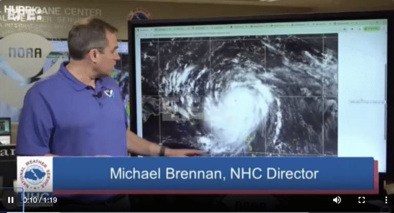
Category 5 Hurricane Erin!
Washington, Aug 16 (EFE).-
The United States National Hurricane Center reported Hurricane Erin rapidly intensified on Saturday to Category 5, the highest on the Saffir-Simpson scale, with maximum sustained winds near 255 kilometers (155 miles) per hour as it advances across the Atlantic.

The cyclone was located approximately 170 kilometers (105 miles) northeast of Anguilla and 375 kilometers (235 miles) east of Puerto Rico. It is moving westward at 28 kilometers per hour (17 miles per hour).
Currently, Erin is not near land; however, authorities have urged people in the Lesser Antilles, the Virgin Islands, Puerto Rico, Turks and Caicos, and the southeastern Bahamas to closely monitor its progress.

Based on the forecast, the center of the hurricane is expected to move just north of the Northern Leeward Islands, the Virgin Islands, and Puerto Rico over the weekend.
The NHC estimates that the storm’s outer bands will dump heavy rainfall over the next few days in these areas.

These rains, with accumulations of 50 to 100 millimeters (2 to 4 inches), may cause flash flooding, urban flooding, and landslides.
The NHC also warned that the storm surge generated by Erin will affect the Lesser Antilles, the Virgin Islands, Puerto Rico, Hispaniola, and the Turks and Caicos Islands over the weekend.

Tropical Storm Erin formed last Monday and became a hurricane on Friday, following the formation of Atlantic storms Andrea, Barry, Chantal, and Dexter. EFE ygg/mcd


