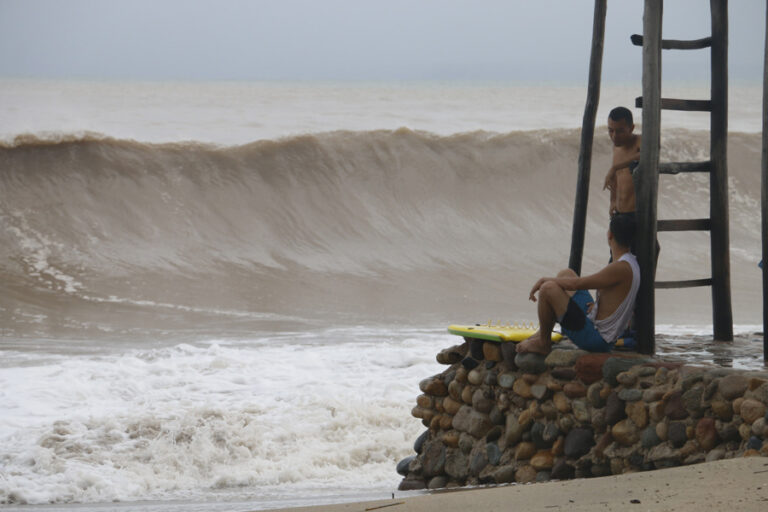
Priscilla, as a Category 1 hurricane, will continue to bring intense rains to the Mexican Pacific.
Mexico City, Oct 6 (EFE)
Priscilla, the sixteenth cyclone of the Pacific season, which strengthened into a Category 1 hurricane on Sunday, will continue to bring heavy rains to western Mexico, Mexico’s National Meteorological Service (SMN) reported Monday.
The SMN said in a statement that the broad circulation of the phenomenon will cause “intense rains in Colima, southern Jalisco, the east and coast of Michoacán, and the southwest and coast of Guerrero.”

The agency said that at 6:00 a.m. local time, the center of the hurricane was located 390 kilometers (km) south-southwest of Cabo Corrientes, Jalisco, and 675 km south-southeast of Cabo San Lucas, Baja California Sur.
It is recording maximum sustained winds of 140 kilometers per hour (km/h), gusts of 170 km/h, and is moving north-northwest at 7 km/h.

Heavy rains (75 to 150 millimeters [mm]) are expected to continue in Colima, southern Jalisco, and eastern Michoacán and the coast; very heavy rains (50 to 75 mm) are expected in Nayarit, and heavy rains (25 to 50 mm)
are expected in Baja California Sur. In addition, winds of 50 to 60 km/h with gusts of 70 to 90 km/h are expected on the coasts of Jalisco and Colima, 30 to 40 km/h with gusts of 50 to 70 km/h are expected on the coasts of Michoacán, waves of 5 to 6 meters (m) high on the coasts of Jalisco and Colima, 3 to 4 m high on the coasts of Michoacán, and 2 to 3 m high on the coasts of Guerrero.

Therefore, the National Meteorological Service (SMN) maintains a tropical storm watch zone from Punta San Telmo, Michoacán, to Punta Mita, Nayarit.
According to forecasts, Priscilla will remain a Category 1 hurricane and could strengthen to Category 2 between Tuesday and Wednesday.
The rains could be electrical and cause flooding, mudslides, and flooding in low-lying areas.

Furthermore, the expected winds could knock down trees and billboards, so authorities urge the public to heed SMN warnings, follow Civil Protection recommendations, and exercise extreme caution in the face of winds and high waves.
So far, 16 storms have formed in the Mexican Pacific: Alvin, Barbara, Cosme, Dalila, Erick, Flossie, Gil, Henriette, Ivo, Juliette, Kiko, Lorena, Mario and Narda, Octave, and Priscilla.

Mexico expects up to 20 named cyclones to form in the Mexican Pacific during the current season, of which four to six could reach Category 3, 4, or even 5 strength.
The last hurricane to hit the country was Erick, which made landfall in southern Mexico on June 19 as a Category 3 hurricane and caused damage in Oaxaca and Guerrero, where a minor died and damaged electrical infrastructure, homes, and trees.


